Ontario: Incoming front will wipe out humidity, fuels severe thunderstorm risk

It's been a tad hot and sticky for parts of southern Ontario this week, but relief is coming Friday night as a cold front sweeps through the province. While this means much cooler air for the weekend, it will bring the potential for widespread thunderstorms, possibly severe, across the south, north and east Friday afternoon. Details and timing, below.
WEATHER HIGHLIGHTS:
Cold front could trigger severe storms in south, north Friday
Cooler, fresher air arrives for the weekend
Keep on top of active weather ALERTS here.
FRIDAY: SEVERE STORM RISK AS FRONT TREKS THROUGH
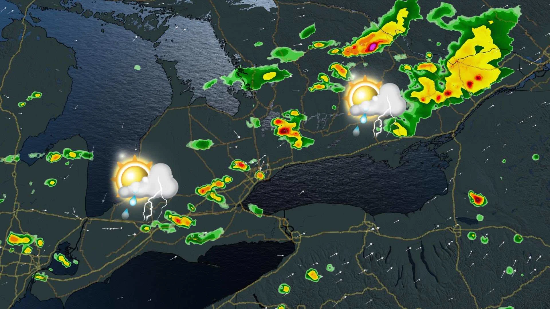
Friday will remain hot and sticky for the most part, but an incoming cold front will wipe out the muggy conditions in the evening. But, ahead of its passage, it could trigger widespread thunderstorms, potentially severe, across the south and in parts of the north, as well.
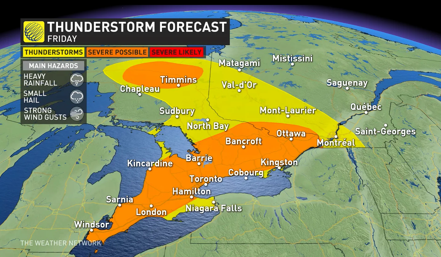
The risk for the thunderstorm development will be through the afternoon hours, with a large swath of southern, central and eastern areas under the threat to see storms reach severe limits. The main threats include small hail, heavy rain and strong winds. Winds will pick up Friday ahead of the front coming through, stronger gusts in thunderstorms.
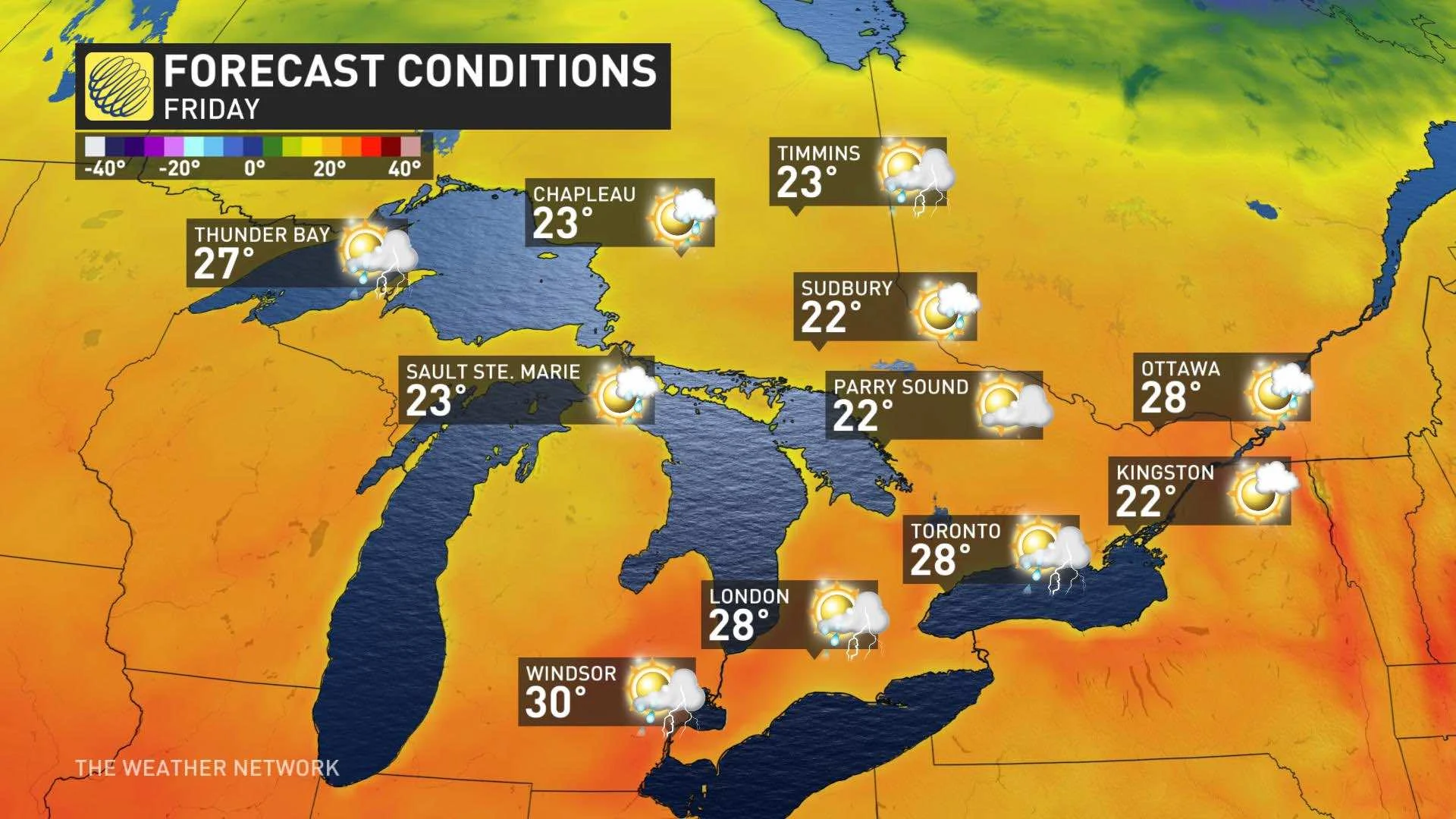
Temperatures will remain warm and humid, with daytime highs approaching the 30s in the south and parts of the east. The southwest may even hit the 30-degree mark. But this will be the last day of summer-like heat for a few days, as much cooler air filters in behind the front.
WEEKEND AND BEYOND: MOSTLY FAIR, MUCH COOLER BUT HUMIDITY WILL RETURN BRIEFLY
By Saturday, temperatures will be much cooler with the humidity all but gone. There could be some lingering instability early Saturday morning, setting up a passing isolated shower in parts of the GTA and eastern Ontario, but most of the region will not see any rain.
Sunday will see similar conditions, with sunshine and daytime highs remaining cool and slightly less than Saturday. The cool, but fair, pattern will continue to start next week, but much warmer and more humid conditions is expected by mid-week with the potential for temperatures to climb into the low-30s for a couple of days.
Forecasters will also be closely watching the remnants of Christobal.
"It is still too early to have confidence in the track and potential impacts of this storm, but at this point it looks like the storm will track well to the west of the region – into the northern Great Lakes and northern Ontario," Weather Network meteorologist Dr. Doug Gillham says.
As the storm tracks into northern Ontario, it should help to drag a cold front across the south with a period of showers and thunderstorms late Wednesday or early Thursday. The front could tap into some tropical moisture. Another cooldown is then expected for late next week into the weekend, continuing through the start of the following week.
Check back as we continue to monitor the forecast.


